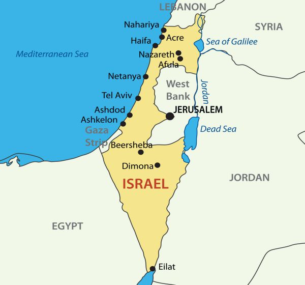
For decades the “two-state” paradigm — which calls for the establishment for an independent Palestinian state to be established in Judea-Samaria (a.k.a the “West Bank”) which fell to Israeli forces in the 1967 Six Day War — has dominated the discourse of the Arab-Israeli conflict.
Opponents of this idea have often warned of the dire dangers that that such an outcome would herald for Israel, however many in the general public have little notion of how potentially perilous a Palestinian state would be for Israel.
(Photo Credit: Mycolors/Dreamstime)
These dire dangers that are graphically illustrated in the following series of photographs taken from sites inside the territory designated for any future Palestinian state.
They demonstrate, dramatically, how vulnerable and exposed Israel would appear through the binoculars of a Palestinian “intelligence officer” (a.k.a. a terrorist).
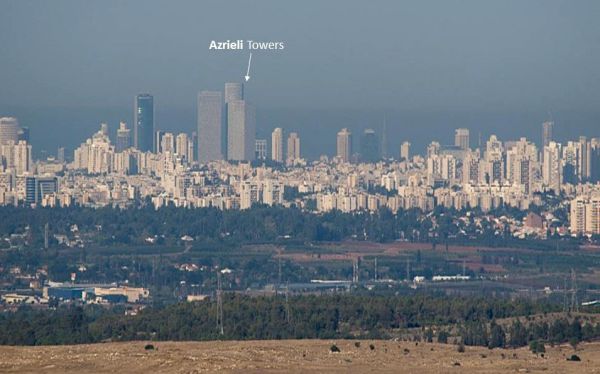
Greater Tel Aviv Skyline as Seen From a Potential Palestinian State
(Photo Credit: Hagai Nativ)
The clearly visible Azrieli Towers complex is an iconic feature of the central Tel Aviv skyline. They house a three-story shopping mall and recreation area, a thirteen-floor luxury hotel, and numerous prestigious commercial companies, including many of the country’s leading law firms. And, oh yes, it is adjacent to the compound (known as “Camp Rabin,” named after the late Yitzhak Rabin) that comprises Israel’s Defense Ministry and the headquarters of the IDF General Staff.
.jpg.aspx)
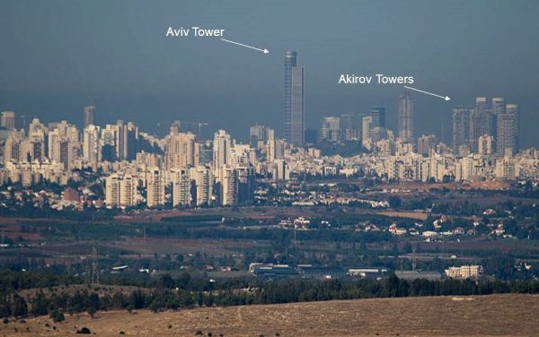
(Aviv Tower from a potential Palestine state - Photo Credit: Hagai Nativ)
The Aviv Tower, located in the bustling vicinity of the Ramat Gan Diamond Exchange (adjacent to Tel Aviv) is the tallest building in Israel. It's surrounded by popular restaurants, cafes, commercial enterprises and recreational facilities. The Akirov Towers, in North Tel Aviv, houses the former apartment of Ehud Barak, underscoring the stunning fact that there is a line of sight between the residence of the former Defense Minister and a potential Palestinian state!
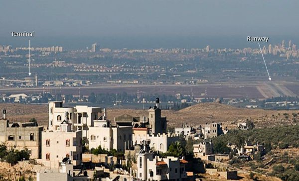
Ben Gurion Airport — Through Binoculars of a Palestinian “Intelligence Officer”
(Photo Credit: Hagai Nativ)
Main Terminal and Runway at Ben Gurion Airport as seen from a potential Palestinian state: This shot underscores just how utterly exposed Israel’s only international airport would be to any hostile elements (renegade or otherwise), deployed on the hills overlooking the main terminal and runway.
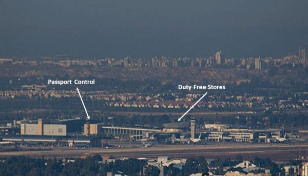
(Terminal - Photo Credit: Hagai Nativ)
For those familiar with Ben Gurion airport, the long inclined corridor connecting the passport control stations with the large duty free area is clearly visible from well within a potential Palestinian state.
A tempting target: The unnerving sight of a plane clearly visible taking off on the main runway — hopelessly exposed to any nefarious forces in the nearby hills inside a potential Palestinian state.
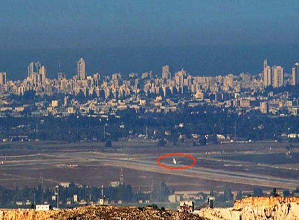
(Ben Gurion runway - Photo Credit: Hagai Nativ)
Israel’s Vulnerable Power Generating Facilities as Seen From a Potential Palestinian State
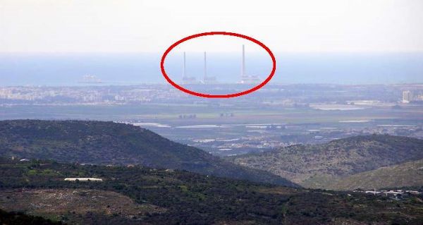
(Hadera - Photo Credit Yohar Gal)
The Orot-Rabin power station, near Hadera (named after the late Yitzhak Rabin): The plant is currently Israel's largest power station with almost 20 percent of the Israel Electric Corporation's total generating capacity. It is adjacent to Caesarea, a very upmarket locality, home to many of Israel’s rich and famous, including current PM Benjamin Netanyahu.
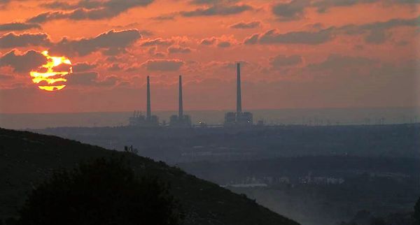
(The Orot-Rabin Power Station at sunset - Photo Credit: Hagai Nativ)
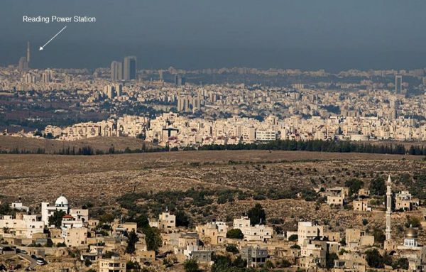
(Reading power station - Photo Credit: Hagai Nativ)
The Reading power station supplies electricity to the Greater Tel Aviv district. The plant is located close to Tel Aviv port, Sde Dov airport and the upmarket neighborhoods of North Tel Aviv and Ramat Aviv, where Tel Aviv University is located. Taken from the vicinity of the Palestinian village of Rantis, visible in the foreground.
Terror Tunnels and Transportation
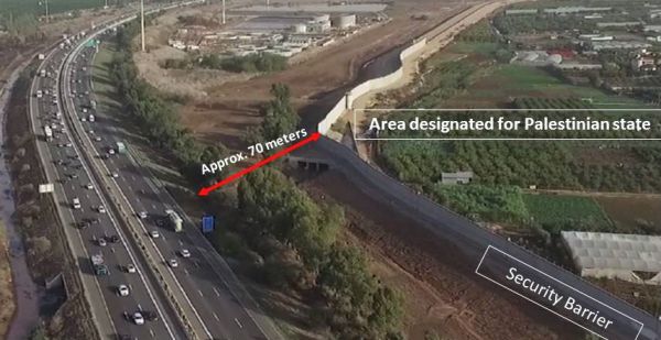
(Route 6, The Trans Israel Highway - Photo Credit: Israel Institute for Strategic Studies)
Taken near the Palestinian-Arab city of Qalquilaya, a hot bed of terror in the past, this drone shot underscores the grave danger to traffic on the Trans-Israel highway (Route 6), connecting the North of the country with the South. In light of the threat of terror tunnels, mortar fire, and rocket attacks emanating from Gaza, little imagination is required to visualize the consequences of evacuating areas abutting one of Israel’s major transportation arteries. For a more detailed explanation click here.
Pictures Worth Thousands of Words
These photos convey the stark, clear and present dangers a Palestinian state would pose to Israel, its urban centers, its vulnerable airport, its major traffic routes as well as its vital infrastructure installations — all of which will be in range of weapons, now being used against it from other territories transferred to Arab control.
Indeed, given the abysmal consequences of past Israeli withdrawals, whenever Israel has relinquished land, it has — sooner or later — become a platform from which to launch attacks against it, who can fault the opponents of the two-state prescription for their grave concern?
Dr. Martin Sherman is the founder and executive director of the Israel Institute for Strategic Studies, dedicated to the preservation and propagation of joint values shared by the USA and Israel as embodied in the U.S. Constitution and Israel’s Declaration of Independence. He served for seven years in operational capacities in the Israeli Defense establishment and acted as a ministerial adviser to Yitzhak Shamir's government. Sherman lectured for 20 years at Tel Aviv University in Political Science, International Relations, and Strategic Studies. He holds several university degrees — B.Sc. (Physics and Geology), MBA (Finance), and PhD in political science/international relations. He was the first academic director of the internationally renowned Herzliya Conference and has authored two books as well as numerous articles and policy papers on a wide range of political, diplomatic and security issues. He was born in South Africa and has lived in Israel since 1971. To read more of his reports — Click Here Now.
© 2026 Newsmax. All rights reserved.